Salt is like other sedimentary rocks and forms horizontal layers but has a low density of 2 grams per cubic centimetre and a low viscosity 1017 Pas which allows salt to flow like a fluid over long timescales.
100 million years ago during the Cretaceous, global sea level rise and warm water temperatures promoted the grown of coral reefs in the Gulf, and the deposition of limestone and chalk. About 80 million years ago, the growth of mountain ranges during the Laramide Orogeny in Central and North-Western North America resulted in the growth of expansive river basins like the Missouri and the Mississippi, which flowed out to south-east America and depositing huge volumes of sediments at the Mississippi delta.
The deposition of massive dense sediments on top of ancient fossils and salt layers caused compaction and overpressure of the salt, and upwards flow. This upwards flow fractured and faulted the overlying rocks, and the combination of impermeable salt with structural traps immobilise fluid migration meaning the oil and gas moving upwards through pore space concentrate where faults intersect salt.

The goal of exploration is to characterise the micro-scale feature of salt and sub-salt reservoirs to best guide drilling. Research institutions like Texas A&M’s Geochemistry and Environmental Research Group supplement industrial surveying with their own studies.

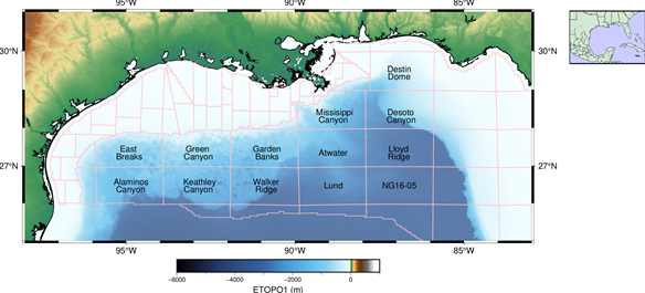
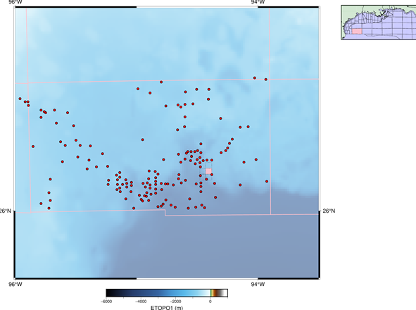
The Walker Ridge hosts 231 academic drilling cores and an abundance of experimental data on gas chromatography, carbon 1-4 headspace studies, and scanning fluorescence. These experimental techniques characterise the quality and concentration of natural resources.
Locations with available drill logs are found all throughout the official protractions and can supplement information that S-Cube yield from creating sub-surface models out of seismic data.
Read more about S-Cube’s work characterising sites within the Walker Ridge here at the Leading Edge Journal @ (https://library.seg.org/doi/full/10.1190/tle42030196.1 )
Keywords:
BOEM, Protractions, Salt, Gas chromatography


